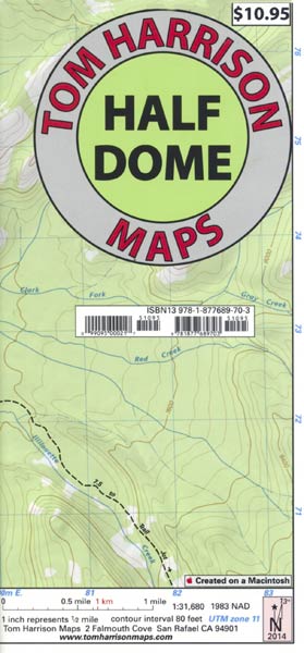
Ideal map for the popular hike to top of Half Dome includes Little Yosemite Valley, Glacier Point, Yosemite Creek, Tenaya Lake, and more.
All of Tom Harrison’s wonderful maps to California hiking and recreation areas are shaded-relief topographic maps on waterproof plastic.
2007, scale: 1 inch=½ mile, 80 ft. contours.
18" x 26-1/2" unfolded, 4-1/2" x 6-1/2" folded
ISBN 1-877689-70-X
Holiday Specials!
From now through December 10, 2008, all retail customers get the following discount:
- 5% on orders of $10 or more
- 10% on orders of $30 or more
- 15% on orders of $100 or more
Returning customers get even larger discounts, and get until December 28 to take advantage of them:
- 10% on orders of $10 or more
- 15% on orders of $30 or more
- 20% on orders of $50 or more
- 25% on orders of $100 or more
Plus, we're offering free shipping on the gorgeous new Bluewater Maps
Books and Maps on Related Topics:
The High Sierra of California by Poems and Journals by Gary Snyder, Woodcuts by Tom Killion
Exploring Eastern Sierra Canyons: Sonora Pass to Pine Creek by Sharon Giacomazzi
Sierra Nevada Topographic Map by Imus Geographics
Trails and Tales of Yosemite and the Central Sierra--A Guide for Hikers and History Buffs by Sharon Giacomazzi
Hetch Hetchy Trail Map by Tom Harrison
John Muir Trail Map-Pack by Tom Harrison
Emigrant Wilderness Trail Map by Tom Harrison
Mammoth High Country Trail Map by Tom Harrison
Hoover Wilderness Region Trail Map by Tom Harrison
A Day in the Ancient Bristlecone Pine Forest by Photographs by Dennis Flaherty, Essays by Mark A. Schlenz
Angels in the Wilderness: The True Story of One Woman’s Survival Against All Odds by Amy Racina
The Good, The Great and the Awesome: Top 40 High Sierra Rock Climbs by Peter Croft, Foreword by Galen Rowell
Bishop Area Rock Climbs, 3rd Edition by Peter Croft and Marty Lewis
Laws Field Guide to the Sierra Nevada by Written and Illustrated by John Muir Laws
Mammoth Area Rock Climbs, 3rd Edition by Marty Lewis & John Moynier, Foreword by Errett Allen
The Hiker's hip pocket Guide to Sonoma County, 3rd edition by Bob Lorentzen
2009 Northern California Tide Charts by Hawaiian Resources Company
Hiking the California Coastal Trail--The Complete Set by Bob Lorentzen and Richard Nichols
Hiking the California Coastal Trail Volume Two: Monterey to Mexico--The Guide to Walking the Golden State's Beaches and Bluffs from Border to Border by Bob Lorentzen and Richard Nichols
2009 Southern California Tide Charts by Hawaiian Resources Company
Chugach State Park/Chugach Mountains, Alaska Topographic Recreation Map by Imus Geographics