
South Marin Trail Map
Tom Harrison
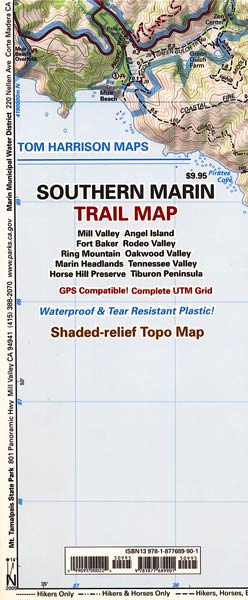
Covers public lands of south Marin County southeast of the Mt. Tam Map. Includes Marin Headlands of Golden Gate National Recreation Area, Fort Baker, Fort Cronkhite, Tennessee Valley, Rodeo Valley, Oakwood Valley, Tiburon Peninsula, Ring Mountain Preserve, Sausalito, Mill Valley, Horse Hill Preserve, Angel Island, and more.
All of Tom Harrison’s wonderful maps to California hiking and recreation areas are shaded-relief topographic maps on waterproof plastic. GPS compatible with complete UTM grid.Bored Feet is not currently accepting retail orders. We will still be filling wholesale orders for the foreseeable future. We apologize for any inconvenience.
